Lexington Weather
Lexington, Massachusetts, USA
- Light rain, Mist, Overcast
-
62.2°F / 16.8°C

-
61.2°F
- 96%
- Calm, 10-min avg: Calm, gust: None
- 6 miles
- 2.04 in
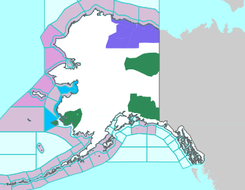
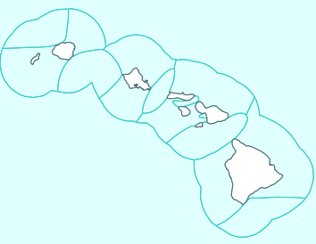
U.S. Severe Weather
Image and data from the National Weather Service.
You can tap click anywhere on the map to get more information about watches and warnings from the local NWS office.

© 2026, LexMAWeather
 @LexMAWeather@toot.community
 @LexMAWeather.toot.community.ap.brid.gy
Site development based on the USA and Meteobridge templates from
Saratoga-Weather.org.
Additional code adapted from
SE Lincoln Weather Scripts.
Weather data and images courtesy the National Weather Service, Environmental Protection Agency, AirNow, Weather Underground / Intellicast, Vaisala Xweather (formerly AerisWeather), earth.nullschool.net, Windy.com, and Leaflet/OpenStreetMap